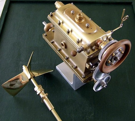
If you didn’t read last week’s post, you should do that first. The picture above is a modern enthusiast’s model of Ofeldt’s invention, explained below.
I occasionally keep a digital diary of what I am writing. If I were better at remembering to make entries, my rearward vision would be clearer. This comes from the entries I made in the last half of 2017.
FYI, Durbar is an Indian term for a ceremony of submission to a Raja, which was later taken up by the British. That is real-world information.
— << >> —
The idea for the Durbar novel came at Westercon 70, July 4 weekend 2017. I began plotting as soon as I returned home, but failed to note the day I started writing. I finished the last chapter at 2:32 PM Monday, Oct. 23, 2017.
I sent completed novel, now titled The Cost of Empire, to Gollancz in London on January 2, 2018. On that same day, I began the first page of a novel with the working title Clockwork Christmas.
— << >> —
Clockwork Christmas later became Like Clockwork. We’ll talk about it another time.
2017 and 2018 were exciting years. It was as if the old days were back.
I had spent fifty years on the ever growing Menhir series, half as long as that working out the kinks in Cyan, and the other books I wrote during those middle years were completed in off hours while I was a working school teacher. Now I was free to write without day-job constraints, and things flowed freely again like they had when I first began.
What? You just want to know about the secret weapon
I mentioned last week?
No, I haven’t forgotten. Britain, in the novel The Cost of Empire, had a secret weapon called the McFarland engine. Our hero discovers that the McFarland engine was stolen from a Swedish-American inventor named Frank Ofeldt.
Ofeldt and his invention are part of our real world, and I already knew about him when I had my epiphany in Tempe. He is deeply obscure and his invention was silly, but it provided the perfect catalyst when The Cost of Empire burst into my consciousness. I would never have heard of him, except for my incessant reading in maritime history.
Ofeldt’s invention in the real world. Ofeldt perfected the naphtha engine, which is somewhere between a steam engine and an internal combustion engine. Naphtha (if you were my age I would just say lighter fluid and you would know what I mean) is heated and the naphtha engine uses it as a steam engine uses steam, to move pistons. Even though naphtha is combustible, it doesn’t burn at this stage.
The naphtha is recovered after passing through the pistons, cooled back to a liquid, then burned to heat incoming naphtha. The resulting engine was both weak and dangerous. It should have disappeared from history. Instead, the Federal government saved it — by accident.
The Feds passed a law forbidding steam engines on boats without a licensed operator. The newly rich of the nineteenth century often had twenty foot launches powered by miniature steam engines that they used to carry their rich friends around their private lakes. Suddenly they were illegal. Naphtha engines were not technically “steam” engines so they found a niche market and survived, at least for a few decades.
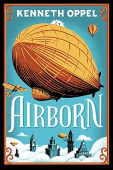
Ofeldt’s invention in the novel. Steam dirigibles existed early on, in the real world and in the novel. They were never practical because of the weight of water and coal they had to carry. In the novel, internal combustion engine technology had been deliberately suppressed. McFarland discovered Ofeldt’s invention, stole it, and produced functioning, if underpowered, fleet of British dirigibles.
i wrapped all of the other technologies in the novel around the naphtha engine. Our hero is a young airman in the British dirigible fleet who discovers the existence of the spy ring, the theft of Ofeldt’s invention, and the crippling blow that the engine’s weakness inflicts on British security. All this occurs while he is trying to understand why Britain won the German War, but is still the most powerful and hated nation on Earth.
— << >> —
If there is a moral here, it must be that nothing you know is useless, no time spent off task is really off task to a writer’s ravenous subconscious, and if a piece of knowledge is obscure, that just means that you get first crack at using it.
None of this answers the questions implied in the titles of these two posts. Is it really steampunk? Probably not.
I wrote The Cost of Empire and Like Clockwork in search of steampunk. When they were finished The Cost of Empire would probably fit better into the sister category of alternate universes. And Like Clockwork would probably be viewed as a classic time travel story.
Well, they both taste like steampunk to me, and categories are ultimately just a book seller’s concern.
The Cost of Empire
will be published next year
on May 12, 2027
Like Clockwork is too far down the queue of completed novels to promise its date of publication at this time.